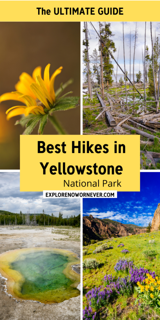
Best Easy Day Hikes Yellowstone National Park
This article may contain affiliate links. This means that when you click on products we recommend through a link, we may earn a small commission at no cost to you. For more information, please read our disclaimer page.
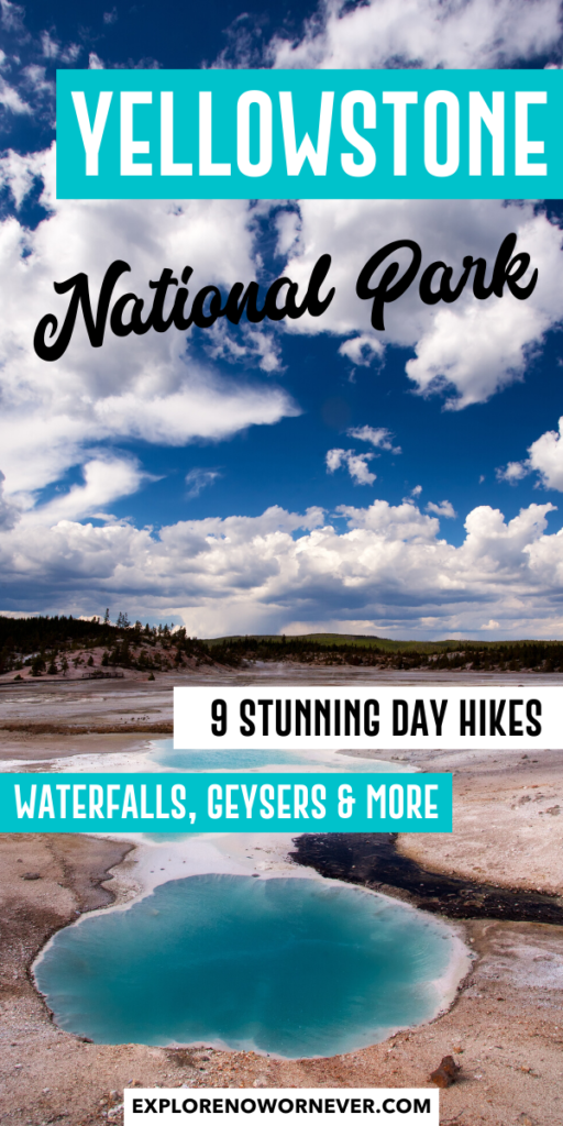
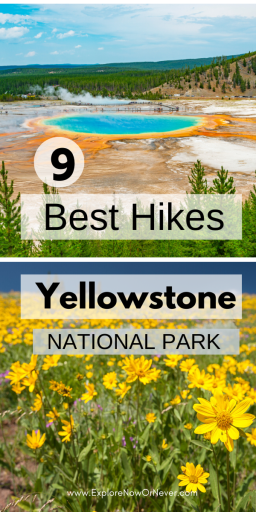
Exploring Yellowstone National Park makes for an incredible adventure. It's a crown jewel in the U.S. national park system. And what better way to do it than ogling waterfalls, trekking through serene forests, and soaking up wildflower-strewn meadows? Here, travel bloggers share their picks for the best of the best hikes in Yellowstone.
Update June 2022: Due to historic flooding, Yellowstone National Park is temporarily closed, with the North Entrance to Northeast Entrance, including Mammoth Hot Springs to Norris, and Tower-Roosevelt to Canyon Village, expected to be remain closed for awhile. Check updates on park closures here.
Contents
- Best Hikes in Yellowstone National Park
- 1. Fairy Falls Trail
- 2. Grand Prismatic Spring OverLook Trail
- 3. North Rim Trail
- 4. Point Sublime Trail
- 5. Lone Star Geyser Trail
- 6. Storm Point Trail
- 7. Clear Lake—Ribbon Lake Trail
- 8. Observation Point Trail (near Old Faithful)
- 9. Osprey Falls Trail
Best Hikes in Yellowstone National Park
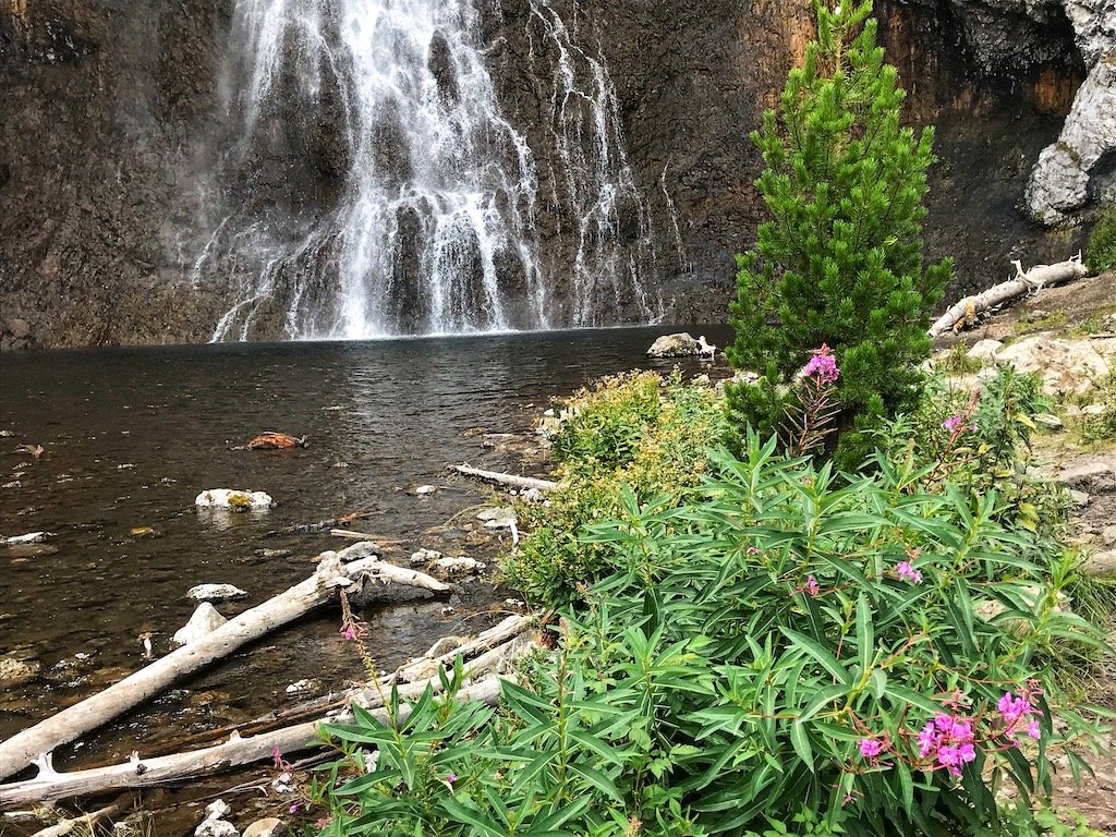
1. Fairy Falls Trail
Distance: 5.4 miles (8.6 km) or 6.7 miles (10.7 km) there and back with just 105 feet (32 m) elevation gain.
Description: This is some of the best hiking in Yellowstone so arrive early if you're hoping to find space in the small Fairy Falls parking lot, just one mile south of Midway Geyser Basin. Otherwise, park at the end of Fountain Flat Drive.
This trail is a spectacular walk to the park's tallest frontcountry waterfall. It's 200 feet high! And the wildflowers here are glorious, due to the fire in 1988 that roared through this area. On your way to the falls, you'll meander through a scenic lodgepole pine forest with an excellent overlook for viewing colorful Grand Prismatic Spring and Excelsior Geyser.
In the past, photographerss of Grand Prismatic Springs were taken on a user-created "unofficial" secret spot. However, a few years ago, a new half-mile "official" trail was completed to replace that trail with an excellent viewpoint.
Top tip: Watch for bears! In summer 2020, a hiker had a skirmish with a bear on this trail. Of course, you can see bears on trails throughout the park so just be cautious and bring your bear spray!
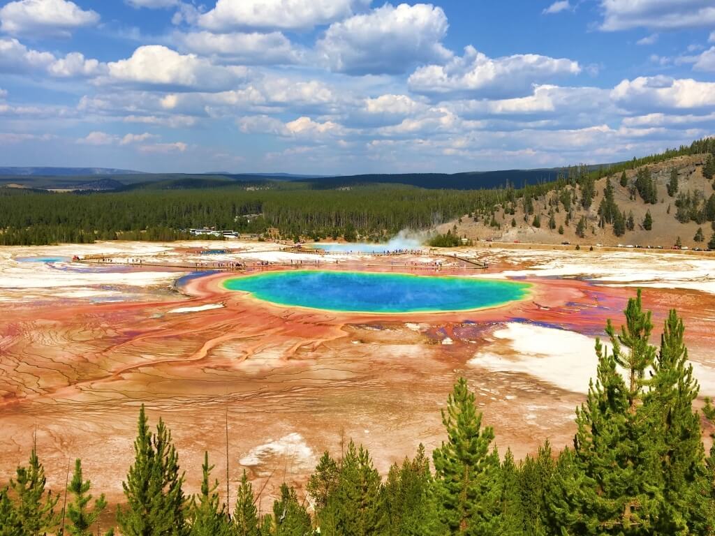
2. Grand Prismatic Spring OverLook Trail
Distance: 1.2 miles (2 km) roundtrip with an elevation gain of 105 feet (32m).
This trail starts as the Fairy Falls trail. It is wide and flat, with the spring off to the right in the distance. After 0.5 miles, there is a signed turnoff to the left to the Grand Prismatic Springs Overlook Trail. From there, it is another 0.1 miles uphill to the overlook.
Description: The trail is well marked and popular (one of the best trails in Yellowstone), so it's easy to find and follow, but can be slippery at times. There are wonderful views of the Grand Prismatic Spring from the overlook. It can be crowded, but people are usually respectful and let others take turns for photos. From the viewing platform, hikers can continue along the trail down to rejoin the Fairy Falls trail to go to the waterfall, or return the way they came to the parking lot.
Tip: It's important not to confuse this hike with the boardwalk trail that goes around Grand Prismatic Spring. The Midway Geyser Basin parking lot has access to the boardwalk for the hot springs. This is worth visiting to see the colors up close and to witness the hot water falling into the river and creating steam.
However, this is not the overlook trail, and there is no trail connecting that parking lot to the overlook trail. Instead, hikers should park at the trailhead for the Fairy Falls hike, about a mile south. Be warned: As noted above, this parking lot fills up quickly.
Although it may be tempting to go early in the morning, the cool of the morning usually creates a lot of mist around the spring, obstructing views of the colorful spring. This usually burns off around noon so time your hike for the afternoon and snap up any parking spot you find.
James|Parks Collecting
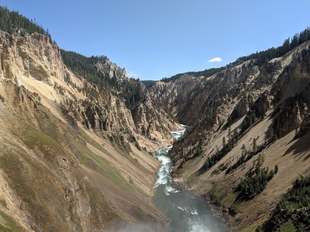
3. North Rim Trail
Distance:- 8 miles (13 km) with over 1000 feet (304 m) in elevation gain.
Description: Many visitors skip the North Rim Trail in favor of the more famous South Rim Trail surrounding the spectacular Yellowstone River. But the North Rim has something you can't see anywhere else.
Starting from either Inspiration Point carpark or Upper Falls carpark, you can use the North Rim trail to access all the major viewing points of the Yellowstone River canyon.
Inspiration Point offers a birds-eye view across the whole river canyon and allows you to take in the wide color variation and beautiful geological marvels.
Tip: Using the wooden staircase, make your way down to the Red Rock viewing point for beautiful panoramic views of Lower Yellowstone Falls from a distance.
Another fantastic and exhilarating viewing point, Brink of the Lower Falls, takes you right to the point where the Lower Falls tips over the edge. The real power of the river can be felt here like nowhere else. Be aware that the switchbacks leading down from the North Rim trail are steep and usually busy.
Nick | Illness to Ultra
4. Point Sublime Trail
Distance: 3 miles (4.8 km) out and back with 250 feet in elevation gain.
Description: Point Sublime Trail is one of the best hikes in Yellowstone National Park and it's easy to see why. It's perfect for hikers of any experience.
The trailhead is located at Artist Point, one of the most picturesque viewpoints of the Yellowstone Grand Canyon and the towering Lower Falls. While many visitors return to their cars after admiring the views at Artist Point, they completely miss this easy trail that offers an incredible view and experience.
What makes Point Sublime Trail so stunning is the fact that this short hiking trail follows the edge of the canyon, delivering unbelievable views of the dramatic canyon carved by the powerful Yellowstone River.
After a short hike, you will reach Point Sublime itself, a guarded area with shade for resting. The view at the end of Point Sublime Trail isn't exactly fantastic, but the journey is what makes it such a great trail in Yellowstone National Park.
Tip: On many parts of the trail, hikers are within a few feet from the perilous cliff and the fatal thousand foot drop. There are no guard rails on this trail, so anyone with a fear of heights must be extra cautious when attempting this hike.
Sean |LivingOutLau
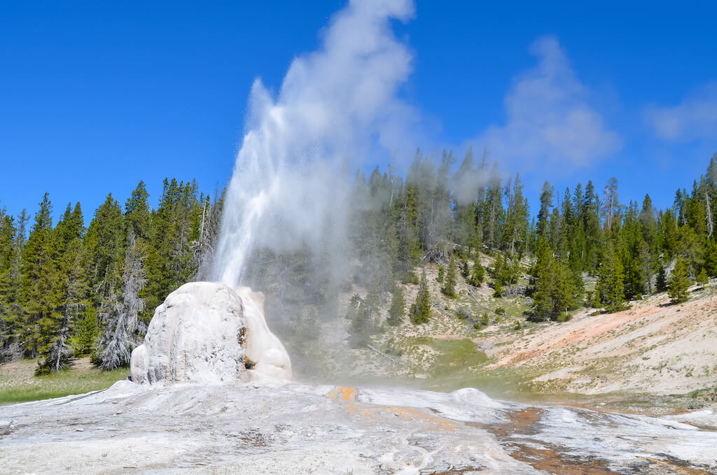
5. Lone Star Geyser Trail
Distance: 4.8 miles (8 km) with an elevation gain of just 22 meters. This hike takes 2 to 3 hours, longer if you wait for the eruption of the geyser.
Lone Star Geyser Trail is one of those "off the beaten path" places in Yellowstone. It is the ideal choice when you want to escape crowds. The trail closely follows the Firehole River through a forest. This mostly paved path is also suitable for bikes. The car park and trailhead is just south from the Kepler Cascade.
Lone Star has one of the largest cones in Yellowstone (10 feet/3 m high) and erupts about every 3 hours. You can look forward to seeing 45-foot (14 m) high eruptions that last about 5 minutes. These are followed by a loud steam phase. You can hear the noise a mile away!
The trail finishes at the junction with Howard Eaton trail (which is part of Continental Divide Trail). From there you can continue to Shoshone lake (which would be a full day trip) or go to the other side to the Old Faithful Village.
There are a number of hot springs between the Lone Star Geyser and the junction. It's a very nice short hike, but keep in mind that you are in the bear country so always follow bear-safety rules!
Tip: Look for the logbook at the geyser to see if previous visitors noted the time of the last eruption.
Andriana | Czech the World
6. Storm Point Trail
Distance: 2.3 miles (3.7 km) loop trail. Elevation gain just 82 feet.
Description: This is an easy, flat hike. You'll find the trailhead 2.5 miles past the Fishing Bridge Visitor's Center as you head east towards Cody, Wyoming.
In summer, you'll walk first past Indian Pond, and then through a meadow of wildflowers until you come to a lakeside trail with big vistas. Walk all the way to wind-swept Storm Point and look for the colony of yellow-bellied marmots in the nearby rocky area here.
Take a breather on the beach (or wade in the lake) before heading back through a peaceful forest of lodgepole pines. Breathe in the sound of silence.
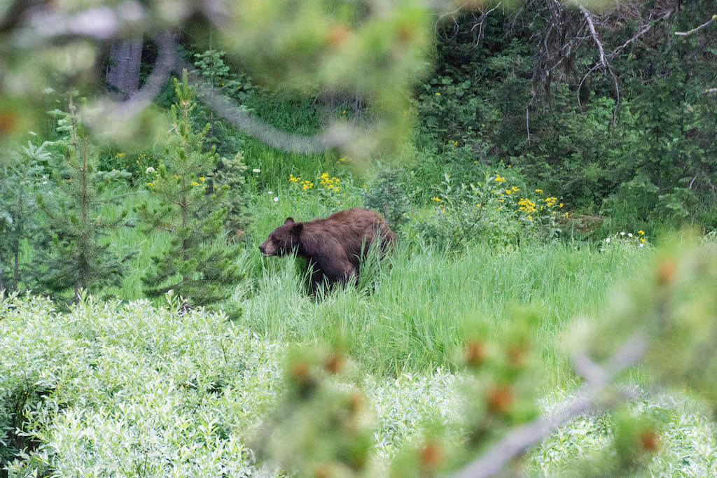
Tip: There is often bear activity here in spring and early summer. Ask for an update at the nearby Fishing Bridge Visitor Center before you head out!
Don't forget to pack bear spray!
Remember…wild animals are wild. It's a magical experience to spot a bear in Yellowstone (and you may spot more of them if you're hiking during the pandemic in summer 2020. They're enjoying the breathing room without the crowds!). Just be prepared. Hike in groups, speak loudly as you walk, and always keep bear spray at the ready (not in a backpack).
It's illegal to carry bear spray on a plane, but if you're driving, you can buy some on Amazon here. Or get some in the park.
Wondering what else to pack? Check out my list of Yellowstone essentials.
7. Clear Lake—Ribbon Lake Trail
Distance: 3.8 miles (6.2km) out and back with options for two different returning loops. Elevation gain is 482 feet (147 m).
Description: This easy to moderate hike is perfect for those visiting Yellowstone with kids, those who love variety, and for those wanting to escape into the backcountry as well as taking in the tourist hotspots.
This hike has it all: wildflower meadows, forests, hydrothermal activity, and options to take in the Grand Canyon of Yellowstone.
Starting at the Waipiti Lake Trailhead, follow the Waipiti Lake Trail for 0.6 miles (1km) and then turn left at the junction to join the Clear Lake-Ribbon Lake trail. In spring and early summer, the surrounding meadows are filled with wildflowers and the flat sprawling landscape is ideal for spotting wildlife, including bison, bears and moose.
The trail enters the forest, with Clear Lake Trail joining from the left (for an alternative route start at Uncle Toms, follow the Clear Lake Trail and join at this junction) and then descends on to the banks of the mesmerizing emerald green and hydrothermal Clear Lake. Stick to the path in this area; the trail passes a number of pools of bubbling mud and simmering steam vents.
Beyond Clear Lake, the path meanders through forest, climbing gradually uphill followed by a steep descent to the Artist's Point connector junction. Continue on the Ribbon Lake trail to the peaceful lilypad-covered waters of Ribbon Lake, where birdwatchers can spot numerous waterfowl.
From here, several options are possible. To lengthen the hike, cross over the outlet stream and hike to the rim of the Grand Canyon of Yellowstone to see the Silver Cord Cascade plummet into the Yellowstone River below. To create a loop, return either on the Waipiti Lake Trail or return to the Artist's Point connector junction, pass Lily Pad Lake, and return via Artist's Point and the South Rim Trail.
Whichever return route is chosen, this hike won't disappoint and is rare in delighting both beginner and experienced hikers with an opportunity to get a taste of all the flavours of Yellowstone's varied and unique landscapes.
Tip: Leave enough time to do the extra trails to Silver Cord Cascade and Point Sublime. Combine with other trails to create a loop.
Joss |Little Green Globetrotter
Save on your parks visit: Get the America the Beautiful Pass
The America the Beautiful Pass is your ticket to freedom! For $79.99, it gives you a whole year of access to more than 2,000 federal recreation sites, including national parks nationwide.
It covers entrance for a driver and all passengers in a personal vehicle or up to 4 adults at sites that charge per person. When you buy through REI, they donate 10 percent of the sale to the National Park Foundation.
Get your America the Beautiful Pass at REI here.
8. Observation Point Trail (near Old Faithful)
Distance: 1.6 miles (2.5 km) with 262 feet (80 m) elevation gain.
Description: Located in the Upper Geyser Basin, in the southwest section of the park, Old Faithful is probably the most popular geyser in Yellowstone National Park. It erupts to a height of 100 to 180 feet, and the frequency of its eruption is reasonably predictable, which is currently at about 94 minutes. Thousands of visitors flock to see this geyser erupt every season.
Hiking the Observation Point Trail is one way to see the geyser erupt from a unique vantage point while avoiding the crowds. To head to the starting point of the hike, walk from the Old Faithful Visitor Education Center to the boardwalk around the geyser, turn right at the Geyser Hill sign, and continue down the path.
The hike is moderately hilly and is frequented by photographers and bird watchers. Time yourself to start at least thirty to forty minutes before the next eruption. The visitor center continuously posts updates about eruption timings. Park yourself at one of the slopes to enjoy a panoramic view of the Old Faithful geyser shooting up into the sky.
Tip: Extend your hike by continuing west to Solitary Geyser before returning to the trailhead.
Supriya | fun travelog

9. Osprey Falls Trail
Distance: 8 miles (13 km) there and back, elevation gain 800 feet (243 m). This hike takes 4 to 5 hours round-trip.
Description: If you find yourself in Yellowstone National Park and are looking for a hike that takes you off the beaten path, head to the Northwest corner of the park near Mammoth Hot Springs to find the trailhead for Osprey Falls. It's a great Yellowstone hike.
You'll head to an impressive 150-foot waterfall that sits inside the gorgeous Sheepeater Canyon on the Gardiner River. Don't let the mileage scare you; the first (and last) 3 miles are flat as you make your way towards (or from) the canyon.
Only mile 4 and 5 require you to descend 800 feet into the canyon and ascend upon your return. With numerous switchbacks, you will hardly notice you are going downhill.
Once you reach the bottom of Sheepeater Canyon, you aren't far from the falls. You will notice that the water twists and turns as it flows down the rocks at Osprey Falls, which means it's a little challenging to get a full view of it, but what you can see, hear, and feel is powerful and stunning.
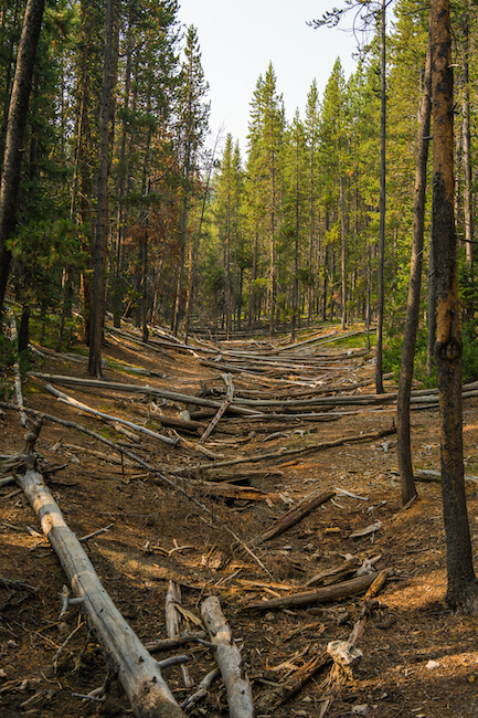
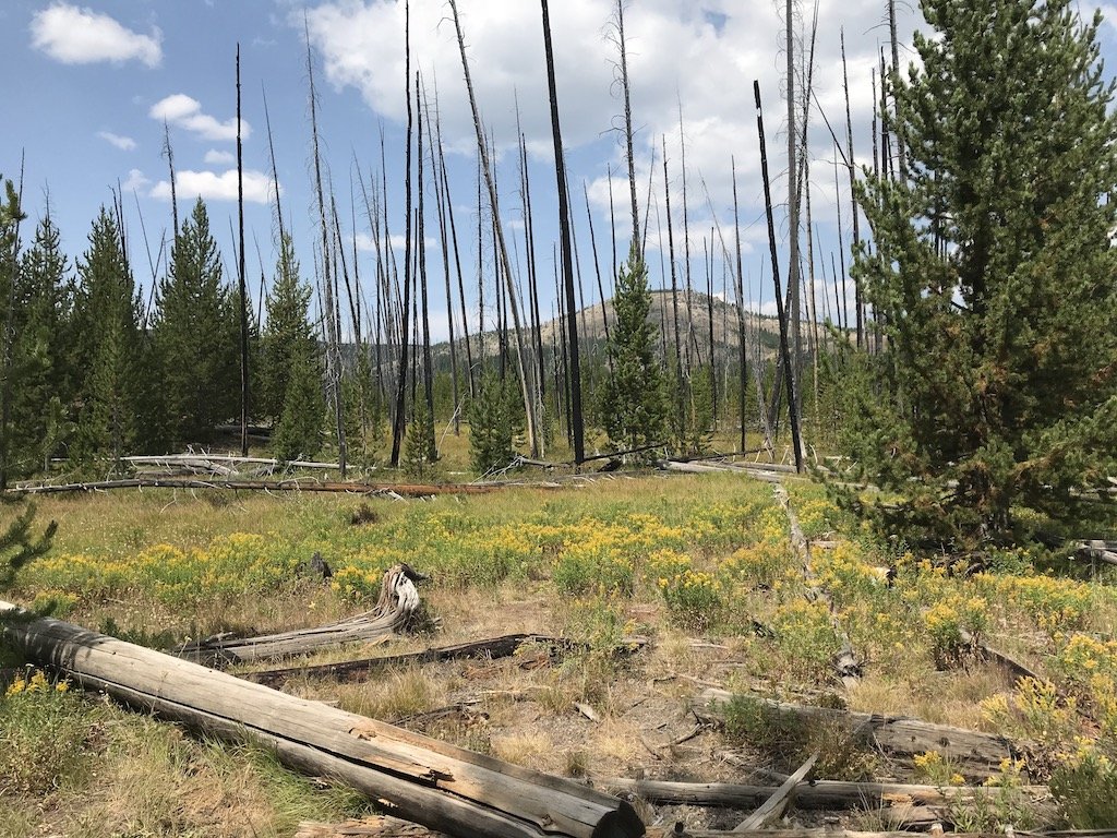
Tip: Beware that most of the trail is exposed due to new growth trees that are thriving after a terrible wildfire in 1988.
Ashely | Impact Winder
Like this post? Pin it for later!
Disclosure: As an Amazon Associate, I earn from qualifying purchases.
Source: https://explorenowornever.com/best-yellowstone-hikes/
0 Response to "Best Easy Day Hikes Yellowstone National Park"
Post a Comment